Case study
Challenges and opportunities in Mali’s Bassin de Sikasso landscape
Communities in Bassin de Sikasso confront a number of unprecedented ecological upheavals which increasingly threaten to disrupt their way of life. An assessment made using the LandScale framework explored these problems, and identified some high-impact interventions that could transform one of West Africa’s most critical agricultural regions.
It shouldn’t be raining like this. Mariam stares out from the shelter of her doorway as the rain falls in thick sheets across the landscape. She looks at the water pooling in the fields, and thinks of her potatoes huddling in the dark soil beneath. If the rain doesn’t stop soon, the whole crop will be lost. She weighs up her options and considers she may have to plant entirely different crops next year — that is, if she’s still in control of the land.
Three months later, Ibrahim has the opposite problem, but he may face the same outcome. He has been expecting the rain for weeks now, watching the soil as it has steadily brightened and turned to dust in the July sun. Maize is a thirsty plant, and these are thirsty times. Like Mariam, he contemplates his options, and his eyes wander to the forest bordering his fields.
These two realities — contradictory yet deeply connected — capture the essence of the Bassin de Sikasso landscape: a region that has sustained communities for millennia but is now caught in a whirlwind of ecological and socio-economic pressures. The LandScale assessment conducted between 2021 and 2025 reveals how rapidly these pressures are intensifying — and how much potential remains when action is coordinated and strategic.
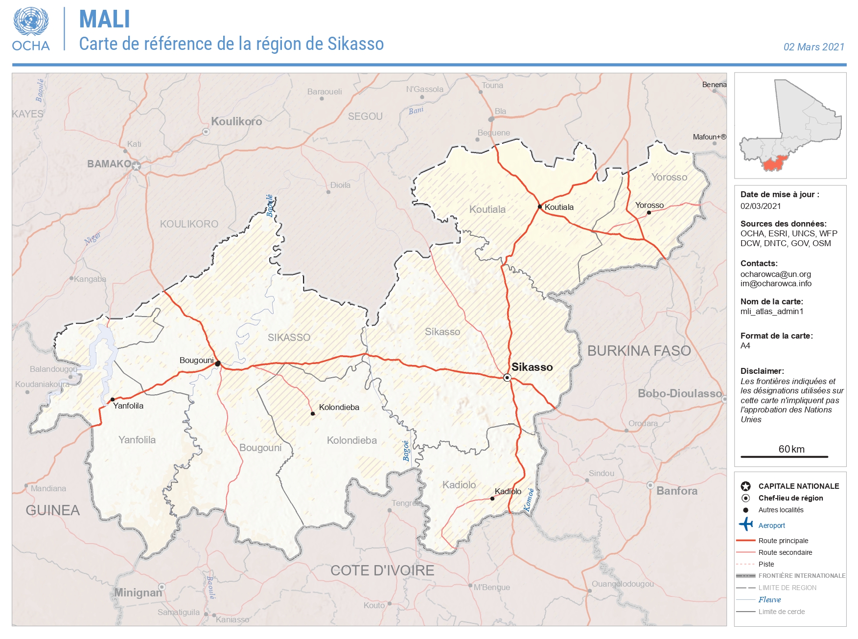
Mali is highly dependent on its agricultural sector, which employs between 60–70% of its workforce and is responsible for 40% of the country’s GDP. Yet it is only the southern regions that contain the land suitable for cultivation, as much of the north belongs instead to the Sahara climatic zone. The south, in which Bassin de Sikasso is located, is therefore essential to Mali’s food security, and it faces an incredible array of ecological, social, and economic challenges.
More than half of the population is under working age, and the population as a whole is increasing at around 3% every year. This places an extreme strain on resources, and means that every year an area larger than Paris is converted from natural savanna to farmland or bare soil. This high land use conversion rate impacts a vast number of other ecological stressors.
Moreover, according to both the International Monetary Fund and the United Nations Development Programme, Mali is one of the countries most susceptible to climate change, with a staggering 40% of its agricultural output at risk. While in complex systems it is never easy to pinpoint the contributions of specific factors, it is clear that the increasing volatility of weather patterns causes rippling effects throughout the entire system.
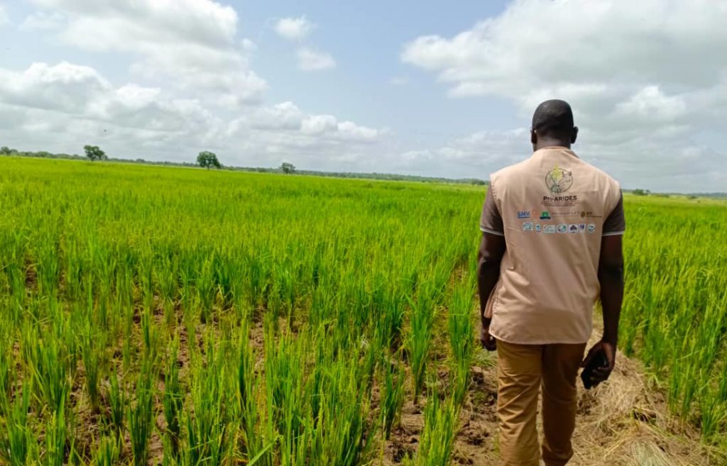
Using LandScale’s framework, experts from SNV and IFDC supported by the Dutch Fund for Climate and Development (DFCD) and Soil Values, spent between 2021 and 2025 recording the changes taking place across the landscape. LandScale’s framework excels in illuminating the interconnections between superficially disparate issues. Thanks to this, the researchers were better able to understand not only what is happening, but also why it is happening and what can be done about it. The data they uncovered reveal a picture both filled with severe challenges, and reasons to remain optimistic.
Agriculture and water: keeping everyone fed when rainfall becomes unpredictable
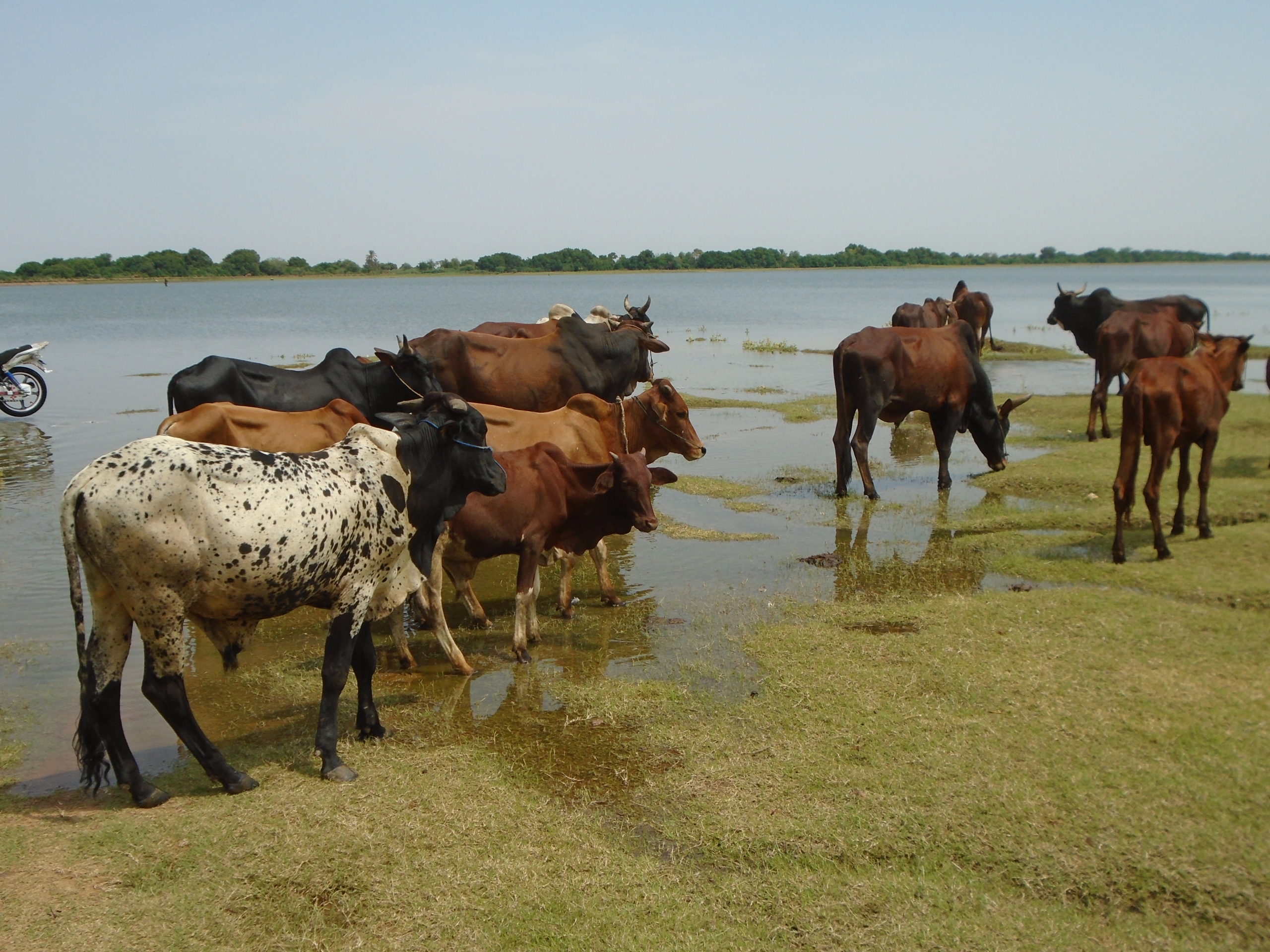
The Niger river, the third longest in Africa, rises in Guinea, close to the border with Sierra Leone. Rather than flowing south a few hundred kilometres to the ocean, it instead flows northward in a sprawling crescent that runs through Mali, Niger, and then finally discharges over 4000 kilometres later in Nigeria. It is known in many languages as “the great river”.
The importance of the Niger and other rivers in the region is impossible to exaggerate. The nutrient-rich sediments deposited by the annual rainy season underpin the whole ecosystem, and intensifying disruption to flooding cycles has real and direct consequences across society and the economy. The central dynamic here is variability. Both drought and flooding are becoming more frequent. Whereas in the past, farmers could make reasonably good predictions about when to plant their crops, this is becoming ever more difficult. The steady rain that once dependably fell during the rainy season has been replaced by long dry periods broken by dense torrents.
The more often crops fail, the more farmers must look for new land to expand into, which often means deforestation and further soil depletion, which decreases connectivity between habitats and reduces diversity. Flood risk rises, and the cycle is repeated. Despite increasing threats to food security, cotton — which heavily relies on pesticide and fertilizer — remains a major crop, as it contributes almost 15% of the country’s GDP. Without viable and profitable alternatives, farmers have little choice but to continue aggravating pernicious feedback loops.
One aspect of the LandScale assessment was a measurement of how much water flows through the Niger and Bani rivers, and how much of that is lost. It went on to reveal a yet more important aspect — the estimated 70% of water that is currently lost through inefficiencies indicates a great opportunity. More efficient irrigation could support dramatic gains in productivity and therefore greater preservation of natural systems. While Ibrahim watches his crops wilt, all the water he needs is rushing by.
How the local people are coping under changing conditions
It is not only fluctuating rainfall patterns which the region’s inhabitants must quickly adapt to — the Bassin de Sikasso landscape faces a vast number of interwoven challenges which intensify with every passing year. The LandScale assessment brought to light the true scale of the population’s everyday hardships, and identified some key areas for future research and investment.
The report shows that 16% of children in the region are undernourished. While cropland has been rapidly expanding, now filling almost a quarter of the landscape, low crop yields explain why this hasn’t been enough to feed all the region’s inhabitants. The assessment found that for every cubic meter of water used, only a suboptimal 33 kilograms of crops were produced.
In addressing this shortfall, the expansion of farmland is effective only as a short-term solution; the long-term cost is grave. In order to expand the area available for cultivation, families must move further into the remaining shrubland and forest, which damages their future sources of fuel for cooking and heating. Since the majority of cooking and heating in the region is done by collecting and burning firewood, this slow variable must be carefully managed. As shrub savannas overtake the wooded ones, journeys to collect materials for making these fires increase. What once may have been a 30 minute task can occupy much of the day, and every cooking fire means more pressure on the remaining forests.
This is also true for water. In Sikasso, 16% of people cannot access clean water within 15 minutes of their home. In Koulikoro, this rises to an astonishing 38%. It is not only crops which would benefit from upgraded infrastructure — every hour that Mariam’s children spend collecting water is an hour that could instead be spent on education.
The growing population puts pressure on all the other variables. As stated previously, the population is increasing at around 3% per year, which translates to an added 115,000 people. Without real economic opportunities, the burgeoning young population may accelerate environmental damage and feedback loops, as families are forced to exploit the remaining resources.
Yet this demographic pattern could also represent enormous potential. With 54% still under working age, job creation could become a critical factor over the following decade. Young people adapt to new approaches more easily than older people, and if they are trained and offered genuine economic opportunity, the next generation could power the adoption of water-efficient farming, renewable energy systems, and sustainable land management practices. Further, a diversification of livelihoods could provide economic security for farming households when one variable, such as rainfall, fails. LandScale’s data shows that education could be transformative. Currently, only 18% of women and 35% of men complete their education. Investing in education, especially for women, could change both economic prospects and resource management within the span of a single generation.
The assessment also demonstrated that better governance at the local and national levels could play an important role. Communities are disrupted by land tenure issues, which severely discourage long-term planning. If a household does not know whether it will remain in control of the same plot of land in the years to come, the inhabitants have understandably little incentive to invest in long-term improvements. The aim must be to create opportunities that don’t depend on extracting more from already stressed natural systems, and to regenerate those that are currently diminished.
This will require a serious levelling-up from the current status quo, in which local people do not have a meaningful say in the planning or implementation of development projects. A polycentric approach to governance which gets local people, businesses and government into one room could support a radical improvement. With this foundation of local knowledge, trust, and agency, initiatives are far more likely to succeed.
What comes next for Bassin de Sikasso — from fragmentation to collaboration
There is no shortage of action taking place in this region. Rather, what has been missing is a comprehensive outlook that allows for genuine coordination. Without a holistic understanding of the issues, conservation and social efforts may operate less effectively in isolation, or even create new and unforeseen problems. The water loss through poor management represents a good example of this — without the full picture, an organization may choose to focus on distributing drought-resistant seeds, while a more efficient investment could be to work with local authorities in improving irrigation infrastructure.
The assessment provides more than just a snapshot. Instead, it gives a dynamic and nuanced vision of a landscape undergoing dramatic and complex changes. Using baseline measurements across a wide range of indicators enables organizations to accurately monitor their progress and to adjust their approaches based on validated results rather than guesswork. The comprehensive assessment identified some key areas for high-impact, coordinated interventions. These include the closing of crop yield gaps, the improvement of water efficiency systems, protection of natural areas, and targeted investments in social programs.
The problems present in the region did not emerge overnight, and neither will the solutions — it will require serious research and collaboration to address the challenges posed by both a burgeoning population and the profusion of environmental upheavals, not least those threatened by climate change. The intricate feedback loops which have caused rapid deforestation and soil degradation will take time and effort to slow and ultimately reverse. This is to say nothing of other problems that fell outside the scope of the current report, such as conflict risks spreading from the northern regions, as well as intensifying competition for land and water between farmers and herders.
For people like Mariam and Ibrahim, the next few years will be critical in determining whether they and their children must expand beyond depleted natural systems and compete for dwindling resources merely to survive. For now, the window for effective action remains open, and the means of achieving it are clearer than ever.
Read more about this landscape in the report here.