Case study
Beyond conservation: Why thriving landscapes must work for people
Many landscape assessments focus primarily on either environmental conditions or human development. The 2024 Mount Kenya Thriving Landscape Baseline Assessment measures both and, in doing so, reveals something that neither a biodiversity report nor a development survey could show alone. Mount Kenya's forests, rivers, and ecosystems support millions of people, yet the assessment finds that ecological progress and human well-being do not always move in tandem. In a landscape defined by its capacity to hold and release water, one in five households still faces the daily burden of water insecurity. That single finding captures the essence of what LandScale's integrated measurement approach makes visible and why it matters.
A landscape that sustains millions
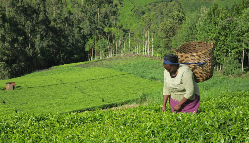
Rising to 5,199 meters above sea level, Mount Kenya is far more than Kenya’s highest peak. It is Kenya’s most critical water tower and one of the country’s most important tea-producing landscapes. Its rivers sustain agriculture, livestock, and drinking water supplies for millions of people across Meru, Nyeri, Laikipia, and Tharaka Nithi counties. The forests that feed these rivers also sequester carbon, shelter biodiversity, and underpin the livelihoods of farming families who have cultivated its fertile slopes for generations.
This is a landscape of extraordinary ecological significance. It is also home to some of Kenya’s most persistent human development challenges. While these realities are often examined separately, the 2024 LandScale baseline assessment brings them together, revealing how the health of the landscape and the well-being of its people are deeply interconnected.
Validated by LandScale, the assessment draws on 27 indicators across four pillars – Ecosystems, Human Well-Being, Governance, and Production – and analyses 319 metric results to establish a comprehensive baseline for tracking progress across the landscape.
When conservation gains are not enough
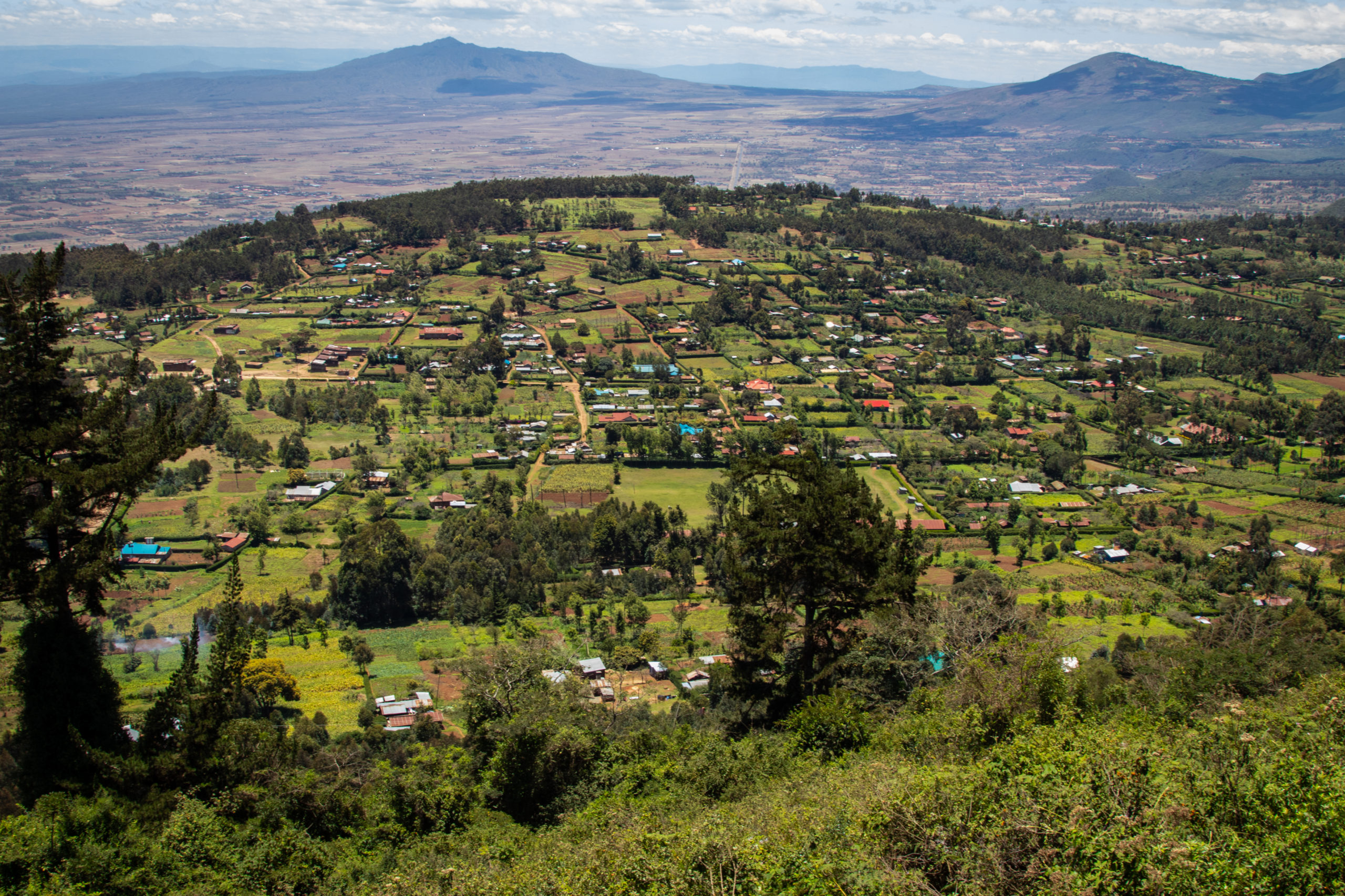
The ecological data tells a broadly encouraging story. Protected areas cover 20.09% of the landscape, surpassing the international Aichi Target 11 benchmark of 17%. More than 537,000 hectares are formally protected over the long term through forest reserves, national parks, and national reserves. An additional 280,000 hectares are conserved through private conservancies, community conservancies, and group ranches.
Restoration efforts are substantial. Across four counties, 34,771 hectares of land are currently under active restoration—more than five times the 6,170 hectares identified as urgently requiring intervention in 2016. Meru County alone accounts for 32,500 hectares of this effort, combining gazetted forest restoration with riparian conservation. And 27.93% of the landscape shows measurable signs of ecological improvement.
The forests are also delivering important climate benefits, with the landscape acting as a significant carbon sink that supports Kenya’s broader climate goals.
Yet the assessment reveals something conservation metrics alone cannot capture: ecological progress and human well-being do not always advance at the same pace.
The gap between a productive landscape and the people who depend on it
This is where the assessment’s human-centered findings become essential—not as a separate story, but as the continuation of the same one.
Begin with water. The Mount Kenya ecosystem is one of Kenya’s most vital hydrological systems. Its forests capture rainfall, regulate river flows, and supply water to downstream communities and farms. And yet, 20% of households in the landscape still lack access to safe drinking water within a 15-minute walk from home. In a landscape renowned for supplying water far beyond its boundaries, this finding reveals a striking disconnect: ecological services that sustain millions do not automatically translate into equitable access for the communities living closest to the source.
The same tension appears in the data on poverty. Despite being one of Kenya’s leading tea-producing landscapes, and a major producer of coffee, bananas, macadamia, and livestock, 28% of residents, comprising roughly equal proportions of men and women, live below Kenya’s rural poverty line. The findings highlight a striking disconnect between the landscape’s strong agricultural productivity and household well-being, with nearly one in three residents still living in poverty despite the economic value generated from these commodities.
Child nutrition tells a similar story. Twenty percent of children in the landscape are stunted, reflecting the kind of chronic undernutrition that accumulates slowly and invisibly over years of insufficient dietary intake. Eight percent are underweight. These figures meet or approach the World Health Organization’s threshold for high concern, in a landscape that produces food at scale.
Households are also exposed to shocks that erode whatever economic footing they have managed to build. Nearly 8% experienced a severe shock in the past year, losing 40% or more of their income or property to a natural disaster or human-caused event. Among female-headed households, that figure rises to 9.2%, reflecting the deeper economic vulnerability that women in this landscape continue to face.
Sanitation compounds these vulnerabilities further. Forty percent of households lack access to a safely managed sanitation facility. Ninety-one percent of households still rely on biomass fuels, primarily firewood, for cooking and heating, a practice with direct consequences for indoor air quality and respiratory health, and an indirect cost borne most heavily by women and children.
Where the landscape is responding
The assessment is not only a record of unmet need. It is also evidence that this landscape is actively building resilience, and that some of its investments are working.
School enrolment stands at 99%, nearly universal and nearly equal between boys and girls. More than 93% of households have access to electricity. Ninety percent of the landscape has formalized land tenure rights, providing a foundation for investment and security that many rural African landscapes still lack. In the formal employment sector, 100% of grievances reported through workplace mechanisms were resolved satisfactorily, and no cases of forced labor were recorded in the landscape’s tea, coffee, or livestock cooperatives.
Women’s participation in economic activities is broad and growing, with 30% of women participating in at least one value chain. Participation is particularly strong in livestock (38.93%) and tea (34.54%), reflecting tea’s importance as one of the landscape’s principal economic sectors. Equal pay for equal work has been achieved in the sectors assessed. Maternal health indicators show 94% of births attended by skilled health providers.
Restoration is not only happening but also accelerating. County governments across the landscape have committed meaningful resources to both gazetted forest and riparian restoration, and biodiversity protection covers more than 83% of identified key biodiversity areas, far exceeding the global 30×30 conservation target.
These signals matter. They demonstrate that change is possible, that institutions are functioning, and that the landscape has the governance foundations needed for collective action.
The LandScale difference: Measuring what matters together
What makes this assessment genuinely different from a standard conservation report or a standard development report is that it measures both realities within a single framework, across the same geography, at the same moment in time.
Most landscape assessments stop at forest cover. Others focus exclusively on household income or child health. Neither approach produces the insight that emerges when both dimensions are measured together: that a landscape can be ecologically important and still leave people behind. That conservation gains do not automatically translate into human well-being. And that, conversely, community poverty and food insecurity can undermine the conditions necessary for long-term ecological health.
LandScale’s integrated approach makes these connections visible, allowing stakeholders to see not only where progress is occurring, but where environmental gains and human outcomes remain disconnected. The 2024 Mount Kenya baseline doesn’t simply show that challenges exist, it shows where ecological performance and human well-being diverge, providing an evidence-based foundation that conservation organizations, county governments, and development partners can use to coordinate action.
The assessment also establishes the baseline against which future progress can be measured. With 27 validated indicators across four pillars, those working in the Mount Kenya landscape now have a shared picture of where they are, and a common language for defining where they need to go. The assessment does not ask whether Mount Kenya is thriving for nature or for people. It asks whether it is thriving for both, and where the gaps between those outcomes remain. By making those connections visible, LandScale provides stakeholders with the evidence needed to align actions, target investments, and track progress toward a landscape that delivers for both people and nature.
A foundation for what comes next
Mount Kenya’s baseline assessment demonstrates that thriving landscapes cannot be measured by forest cover alone. They must also be measured by whether children are nourished, whether households can access safe water, whether communities can withstand shocks, and whether economic opportunities reach those who depend most on the landscape.
By bringing these dimensions together, the 2024 assessment provides something rare: a shared understanding of how ecological health and human well-being rise and fall together. That understanding is the foundation for action.
The forests hold up rivers. The rivers hold up farms. The farms hold up families.
The future of Mount Kenya depends on all of them thriving together.
Measuring the entire chain—not just its most visible part—makes better decisions possible.